Editorial for Baltic OI '12 P2 - Mobile
Submitting an official solution before solving the problem yourself is a bannable offence.

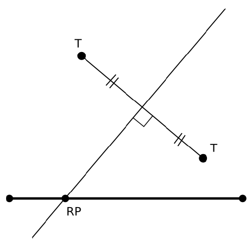
You can get a very easy solution by noticing that the only relevant points of the highway are its endpoints and the intersections with the perpendicular bisectors of the line segments that connect pairs of distinct transceiver stations. Location of these points is
You can now calculate the distance from each of these points to the nearest transceiver. This solution takes time.
With some optimizations for finding the nearest station, you can improve the
performance to .
DP solution that checks all distinct pairs of transceivers takes time.
A better solution is to do a binary search for the maximum distance of a point on
the highway to the nearest transceiver station. You will need to check, if some
fixed distance will cover the entire road. So this solution will take
, where
is the maximum coordinate of a point.
The best solution is the following: using a stack, you go through the transceivers
from left to right. You pop one element from it, if you can verify that it cannot be the
closet station for any point on the road. The sorting in the beginning takes
, but if the input is already sorted, you can achieve
.
Comments